
Webinars Archives
Discover free public data, tools, and resources from GeoTech Center

Learn about the Future of Census Bureau Data Dissemination
Explore How the GeoTech Center 3.0 Can Help You
Join us as Vince DiNoto, Director of the National Center for Excellence in Geospatial Technology, shares how the recent five-year funding will affect the geospatial community landscape.
The National Geospatial Technology Center of Excellence, GeoTech Center, is a collaborative effort between 2-year colleges, universities, and industry to assist in the expansion of a well-qualified geospatial technology workforce. Center partners work together to provide professional development opportunities, curriculum resources (for both educators and students), document career pathways, and research core competencies for the new and incumbent geospatial technology workforce. The Center has served as the national, unifying voice and support system for 2-year colleges, and is recognized by the U.S. Department of Labor as a leader in supporting geospatial technology education.
The National Geospatial Technology Center of Excellence, GeoTech Center, is a collaborative effort between 2-year colleges, universities, and industry to assist in the expansion of a well-qualified geospatial technology workforce. Center partners work together to provide professional development opportunities, curriculum resources (for both educators and students), document career pathways, and research core competencies for the new and incumbent geospatial technology workforce. The Center has served as the national, unifying voice and support system for 2-year colleges, and is recognized by the U.S. Department of Labor as a leader in supporting geospatial technology education.
Recording URL: https://www.directionsmag.com/webinar/4417
Promoting geospatial education in Europe
The exchange of best practices for geography and GeoICT is needed to transfer innovation to meet changing labour market needs and improve the quality of geo-education. In a European context this must be based on developing both EU education and training policies as well as national legislation and curricula. A complex task! This webinar will explore some of the challenges faced by geo-educators in Europe and discuss how the European Association of Geographers has sought through the YouthMetre and GeoSkills Plus projects to make an impact in this area.
GeoSkills Plus, was a 2 year funded project which aimed to match labour market needs with GeoICT education offers in Europe. Reseearch was undertaken to explore this issue and the outcomes and further actions are presented. The aim was to enable European countries to exchange best practices and innovation with each other regarding the mismatch between Europe’s GeoICT needs and the growing geospatial labour market.
The project demonstrated there remains an increasing need for well-trained students at all levels – vocational, bachelors, masters – in the field of geotechnologies. This is because the European open data revolution has resulted in considerable entrepreneurial activity and a growing number of jobs available in land surveying, mapping data collection, data processing, data delivery and turning data into information. The webinar explores follow up actions.
The need to connect young people to the data and information revolution is at the heart of the YouthMetre project. This is a Forward Looking project, to support EU Member States, municipalities and regions in carrying out effective policy reforms in the field of Youth, in line with Europe 2020 goals and the EU Youth Strategy. YouthMetre seeks to increase the participation of young people (aged 18-35) in democratic life is central to delivering successful EU youth policy, in which employment and entrepreneurship, education and social inclusion are priorities.
In order to achieve this, YouthMetre (http://www.youthmetre.eu) proposes and field-tests an innovative Geo-ICT solution in the youth field, in at least 20 European countries, with the potential to improve and/or transform policies and practices. The project aims at directly providing youngsters with necessary skills and knowledge to foster effective implementation, by policy makers, of the guidelines provided by the “Youthmetre”.
Through innovative projects like GeoSkills Plus and YouthMetre, this webinar will explore the significance of open data, geospatial activities and policy actions essential to promote and enhance geo-education and geoinformation literacy at different levels in Europe.
Key words: Geoskills, careers, geotechnology, transfer of innovation, youth, open data, geo-education.

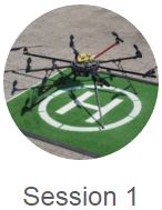
What changed?
Understanding the Updates to FAA Drone Regulations
10:00am EST |

When is a lawyer needed?
Understanding the legal issues surrounding drones
12:00pm EST |

What equipment and software do I need to get started?
Understanding what's needed for your drone mission
2:00pm EST |
Links to Presentations including hyperlinks for additional information: https://drones.directionsmag.com
All You Need to Know about the New GIS&T Body of Knowledge
Presented By:
Dr. John Wilson, University of Southern California and Dr. Ola Ahlqvist October 26, 2016 2:00pm (ET) to 3:00pm (ET) Abstract: Did you ever wonder about the Knowledge Areas that contributed to the GISCI Core Technical Exam? Or were you curious about the legacy documents that added to USGIF’s Essential Body of Knowledge? Join us as we explore the new digital edition of the Geographic Information Science & Technology Body of Knowledge (GIS&T BoK), published by the University Consortium for Geographic Information Science (UCGIS). Learn how the new GIS&T BoK will continue to guide and support curriculum design and review at multiple levels of education, and understand how you can contribute to the project by authoring and reviewing its content. UCGIS has taken a vastly new approach with this digital version, the first update since the original GIS&T Body of Knowledge was published in 2006. Over time, all Topics will be converted to full peer-reviewed entries, with an expanded narrative section as well as additional instructional resources. This new and revised content will be updated on a continual basis, and previous versions will be archived quarterly. While all Topics are still associated with ten Knowledge Areas, some of those Knowledge Areas themselves have changed. A full editorial team is in place, and subject-matter experts are encouraged to contribute an entry or two. In this manner UCGIS has designed the product to be a much more current and community-driven publication, reflecting the ways in which GIS&T knowledge and applications continue to expand. Recording URL: https://www.dropbox.com/s/7mn4jra0nqftxyc/DGSS-BoK2%20Webinar.mp4?dl=0 |

Dr. John P. Wilson is Professor of Sociology and Spatial Sciences in the Dana and David Dornsife College of Letters, Arts and Sciences at the University of Southern California where he directs the Spatial Sciences Institute as well as the Geographic Information Science & Technology (GIST) Graduate Programs and GIS Research Laboratory, and also holds adjunct appointments as Professor in the School of Architecture and in the Viterbi School of Engineering’s Departments of Computer Science and Civil & Environmental Engineering.
He founded the journal Transactions in GIS in 1996 and has served as Editor-in-Chief since its inception. He has served on the editorial boards of Applied Geography(1992-2001), the Annals of the Association of American Geographers (2006-2009), the Journal of Geo-Spatial Information Science (2011-2016), and the Annals of the Association of American Geographers Review of Books(2013-2016). He has chaired the Applied Geography Specialty Group of the Association of American Geographers (1989-1991) and the Research Committee of the University Consortium for Geographic Information Science (UCGIS) (2002-2005). He served on the Board of Directors (2003-2006) and as President of UCGIS from 2006 to 2007. He currently serves as Editor-in-Chief for the UCGIS GIST Body of Knowledge 2.0 project and is an active participant in the UNIGIS International Network, a worldwide consortium of 10+ institutions that develops and delivers online geographic information science academic programs. His research is focused on the modeling of human and environmental systems and makes extensive use of GIS tools, spatial analysis, and computer models. He has published numerous books and articles on these topics, including two edited volumes, Terrain Analysis: Principles and Applications (2000) and the Handbook of Geographic Information Science (2008). Much of this work is collaborative and cross-disciplinary in character with the general goal of improving our knowledge and understanding of the factors linking people, their environments, and their health. 
Dr. Ola Ahlqvist is Associate Professor in Geography and part-time Director for the Office of Service-Learning at Ohio State. He has worked professionally with local and regional environmental planning in Finland and Sweden in the early 1990's. After completing a PhD in Geography at Stockholm University in 2001 followed by post-doctoral training at Penn State University he joined the Geography Department at The Ohio State University in 2005. His research interest span three broad areas: 1) semantic uncertainty and formal ontology in analysis of geographic information, 2) how online maps, social media, and games combine to offer novel forms of social-environmental simulation, and decision making, and 3) the scholarship of engagement in GIS and experiential learning.
|
|
Ethics in GIS Education and Professional Practice
Presented By: David DiBiase, Director of Education, Esri September 21, 2016 2:00pm (ET) to 3:00pm (ET) Abstract: Awareness of ethical pitfalls, and the ability to apply moral reasoning skills when confronted with ethical challenges, is part of what it means to be a geospatial professional. It should also be part of what students learn about GIS and GIScience. During his presentation, DiBiase plans to:
Recording URL: https://attendee.gotowebinar.com/recording/2746677180677804545 |

David DiBiase, Director of Education, leads Esri's education outreach program. He also teaches professional ethics part-time for Penn State University, where he founded its online certificate and master’s degree programs in GIS. David was principal investigator of the NSF-sponsored GIS Professional Ethics project, and is a former President of the GIS Certification Institute. He was lead editor of the first editions of the Geographic Information Science and Technology Body of Knowledge and the U.S. Department of Labor's Geospatial Technology Competency Model. David currently serves as a National Councillor of the American Association of Geographers. Beyond work, his pastimes include hiking, running, cycling, good wine, and classic jazz music - not necessarily in that order.
|
|
Latest Developments in Oceanographic Applications of GIS
Presented By: Dr. Dawn Wright, Chief Scientist of Esri April 13, 2016 2:00pm (ET) to 3:00pm (ET) Abstract: This talk will provide an overview of how intuitive data analytics and visualization tools in geographic information systems (GIS) to inform ocean science both at sea and ashore. Increasingly, GIS is part of the collaboration between ocean scientists, computer scientists, and information scientists to solve complex scientific questions. Successfully addressing scientific problems, including for regional decision- and policy-making within coastal zone management and marine spatial planning, requires integrative and innovative approaches to analyzing, modeling, and developing extensive and diverse data sets. Contributing viable solutions to these problems is part of an emerging science agenda for the ocean sciences, including the ocean GIS initiative at Esri. And further, in the brave new world of science communication we know that scientists can be powerful storytellers as well. We may get the idea from maps, perhaps occasionally from graphs, but we are hardwired to understand stories. Every single scientific success is perfect fodder for a narrative structure. In that vein, the talk will conclude with an introduction to "story maps" as a fast and simple platform for telling compelling stories with ocean science data, including photos, videos, sounds, and sensor dashboards. Dawn Wrights Presentation Video for slide 31 of Dawn's Presentation |

Dr. Dawn Wright is chief scientist of the Environmental Systems Research Institute (aka Esri), a world-leading geographic information system (GIS) software, research and development company. As chief scientist, Dr. Wright aids in formulating and advancing the intellectual agenda for the environmental, conservation, climate, and ocean sciences aspect of Esri's work, while also representing Esri to the national/international scientific community. She maintains an affiliated faculty appointment as Professor of Geography and Oceanography in the College of Earth, Ocean, and Atmospheric Sciences at Oregon State University.
Dr. Wright’s research interests include geographic information science; ocean informatics and cyberinfrastructure; benthic terrain and habitat characterization; and the processing and interpretation of high-resolution bathymetry, video, and underwater photographic images. She has authored or co-authored more than 130 articles and five books on marine geographic information systems, hydrothermal activity and tectonics of mid-ocean ridges, and marine data modeling and cyberinfrastructure. Dr. Wright has participated in over 20 oceanographic research expeditions worldwide, including 10 legs of the Ocean Drilling Program, three dives in the deep submergence vehicle Alvin and twice in the Pisces V. Her fieldwork has taken her to some of the most geologically active regions of the planet, including the East Pacific Rise, the Mid-Atlantic Ridge, the Juan de Fuca Ridge, the Tonga Trench, and volcanoes under the Japan Sea and the Indian Ocean. Dr. Wright serves on the Science Advisory Boards of NOAA, the EPA, and Conservation International, as well as many journal editorial boards. She is a AAAS Fellow, as well as a fellow of Stanford University's Leopold Leadership Program. In 2007, she was named U.S. Professor of the Year for the State of Oregon by the Carnegie Foundation for the Advancement of Teaching and the Council for the Advancement and Support of Education. Dr. Wright holds an Individual Interdisciplinary Ph.D. in Physical Geography and Marine Geology from UC-Santa Barbara, an M.S. in Oceanography from Texas A&M, and a B.S. cum laude in Geology from Wheaton College (Illinois). Other interests include road cycling, apricot green tea gummy bears, 18th-century pirates, her dog Sally, and Spongebob Squarepoints. Follow her on Twitter @deepseadawn |
|
Drone Law for Geospatial Professionals and Educators - Present and Future Considerations
Presented By: Jonathan B. Rupprecht, Esq. March 16, 2016 2:00pm (ET) to 3:00pm (ET) Abstract: Geospatial professionals and educators are seeing unmanned aircraft technology take off- literally. The technology is here and the needs are great, but one of the major barriers to entry is the legal aspects for drones. The FAA considers drones to be aircraft; thus, they are subject to the Federal Aviation Regulations. This causes many individuals to ask questions. In this presentation, the presenter will discuss: (1) the different types of aircraft and what is legally required for each to fly, (2) the operational problems that public and commercial drone operations have under the Federal Aviation Regulations, (3) legal issues from a state and local level that can affect your operations, (4) what the future holds, and (5) what you can now do to successfully position yourself for the future. Recording URL: http://snhu.adobeconnect.com/p5leco065rl/
|

Jonathan B. Rupprecht is a drone lawyer and a commercial pilot with single-engine, multi-engine, and instrument ratings. He is also an airplane flight instructor and instrument flight instructor. Newsweek, Politico, NPR, Marketwatch, The Independent, Motherboard, and many other sources have cited or quoted him. Jonathan obtained a B.S. from Embry-Riddle Aeronautical University, Magna Cum Laude, and a J.D. from Florida International University School of Law. Jonathan authored Drones: Their Many Civilian Uses and the U.S. Laws Surrounding Them. He later was an advisor for one of the amicus briefs for the highly publicized Huerta v. Pirker case. He co-authored a legal treatise on unmanned aircraft that is being published by the American Bar Association. Jonathan is currently practicing drone law in South Florida at his firm Rupprecht Law, P.A. (www.jrupprechtlaw.com
| ||

|
We are pleased to announce the following expert speakers for Drones Flying Free 2016 which takes place on Wednesday, February 17th. Drones Flying Free is a virtual exploration of issues, insights and integration of unmanned aerial vehicles. Attend live from the comfort of your office, home office or mobile device.
|

|
|

|
|

|
|
Alan Perlman
Founder & CEO UAV Coach |
Ron Behrendt
Behron & Associates |
Cody Benkelman
Technical Product Manager - Imagery, Esri |
Chris Cruz, GISP
Park Management & Geospatial Technology, West Valley College |
Paul Schneider, GISP
Transmission Line Support, Georgia Power |
Wednesday, February 17th, 2016
Attend live from the comfort of your office, home office or mobile device.
Rules
What are the rules and how do you follow them?
10:00 AM - 11:00 AM EST
Education
Learning with drones - how educational environments are flying new frontiers
12:00 PM - 1:00 PM EST
Workflows
From flight to impactful maps - Workflows and Data insights
2:00 PM - 3:00 PM EST
Rules
What are the rules and how do you follow them?
10:00 AM - 11:00 AM EST
Education
Learning with drones - how educational environments are flying new frontiers
12:00 PM - 1:00 PM EST
Workflows
From flight to impactful maps - Workflows and Data insights
2:00 PM - 3:00 PM EST
All recordings, slide decks, and resources can be found here: http://drones.directionsmag.com
|
GeoTech Center/URISA Undergraduate Geospatial Technology Competition Winners: Tomorrow’s Geospatial Workforce
Presented By: Molly Finch, Community College of Baltimore County Amy Halloran, DePaul University Kevin McMahon, Community College of Baltimore County December 16, 2015 2:00pm (ET) to 3:00pm (ET) Recording URL: http://snhu.adobeconnect.com/p1bwtjx64fi/
|
Abstract:
This webinar presents the student winners of the GeoTech Center/URISA Undergraduate Geospatial Technology Competition winners as presented in October 2015 in Spokane, WA as part of the GIS-Pro & NWGIS2015 Conference. Each of the four students will present their winning project, including:
| ||||||
|
GISP - Professional Certification From a Student Perspective
Presented By: Bill Hodge, Executive Director of GISCI November 18, 2015 2:00pm (ET) to 3:00pm (ET) Recording URL: http://snhu.adobeconnect.com/p18d75wxkj8/
|
Abstract:
This presentation will review the GIS Professional Certification known as the GISP. It will provide a brief history of its inception and a description of its administration by GISCI, the GIS Certification Institute, including the latest Geospatial Core Technical Knowledge Exam just added to the process. It will educate students about considering a professional certification during a career, and why it is never too early to start considering their place in the GIS profession and promoting themselves as a professional. | ||
|
Geospatial Programs in Higher Education: Lessons Learned and Resources Leveraged by Current NSF-ATE Projects
Presented By
2:00 pm (ET) to 3:00 pm (ET) Recording URL: http://snhu.adobeconnect.com/p168miqhwzg/
|
Abstract:
This session will highlight current National Science Foundation ATE Projects in geospatial technology. Discussions will focus on the ATE grant development process, team development, challenges, and typical objectives of geospatial ATE projects. Specific highlights of the session will involve discussions around current resources like curriculum models, teacher professional development, marketing materials, and other resources relating to promoting the development of viable geospatial technology programs at community colleges and universities. Time will be budgeted to account for any questions or comments to the panel to address issues of best practices, lessons learned, and potential future challenges to support the expansion of geospatial technology within undergraduate education programs. This webinar is expected to be useful to both existing NSF-ATE grant holders, but as well faculty or administrators looking to explore developing a successful ATE proposal to promote a new STEM program initiative. | ||
|
UAVs 101 and Staying out of Jail
Presented By: Dr. Michael Hauck Executive Director, ASPRS September 16, 2015 2:00pm (ET) to 3:00pm (ET) Recording URL: http://snhu.adobeconnect.com/p6w6peyhgj6/
|
Abstract:
What is a UAV, how does it work, and what are some of the types appropriate for civilian and classroom use? And, what are the applicable rules and regulations that an educator, local government, or private company must follow? This webinar will begin with a high-level overview, but quickly dive into the myths and misconceptions that people may have about what can and cannot be done lawfully with a UAV. The session will be as interactive as possible, with provocative slides that are intended to illicit discussion. By the end of the webinar, participants should have acquired the basic framework of technology and the law that will allow them to further research their particular interests on their own. (Disclaimer, the speaker is not a lawyer, and will not be providing legal advice. Rather, he will be providing references to the law as background information so you attendees can speak knowledgeably with a legal professional.) | ||
|
How Can Geospatial “Big Data” Help Disaster Response and Track Disease Outbreaks? Transform Innovative Geospatial Technology to Solve Real World Problems Presented By: Ming-Hsiang (Ming) Tsou, San Diego State University Affiliation: San Diego State University, Geography Department August 19, 2015 2:00pm (ET) to 3:00pm (ET) Recording URL: http://snhu.adobeconnect.com/p8nznu55aej/
|
Abstract:
Geospatial Big Data (GBD) provide untapped potential for discovering and analyzing dynamic human problems, including disease outbreaks, traffic jams, urban dynamics, and environmental changes. Such data offer golden opportunities for GIS scientists and professionals to develop new tools, new methods, and new theories. We can utilize Geospatial Big Data to transform innovative geospatial technology into practical software solutions or computational models for solving real world problems (such as epidemics, disaster response and recovery, health disparities in cancer and obesity, drug abuse, urban crime rates, etc.). We, as GIS professionals, should integrate spatial science (GIS and GPS technologies), mobile technologies (smart phone and mobile apps), and big data (social media, mobile phone records, and web pages) and build a new transformative research agenda for future geospatial education and trainings. The term ‘big data’ usually refers to large stores of information accessible to secondary analyses. Such data have the potential to translate into big ideas, big impacts, and big value for our society. GIS and spatiotemporal analysis methods are essential tools for processing, filtering, analyzing, and visualizing big data. This webinar will discuss the impacts of big data and social media from a geospatial technology perspective and introduce a few software solutions and examples for disease outbreak surveillance and disaster response/assistance. Two web applications developed by the Center of Human Dynamics in the Mobile Age (HDMA) (http://humandynamics.sdsu.edu/research.html) at San Diego State University will be introduced to demonstrate the value of geospatial big data. The web-based Social Media Analytics and Research Testbed (SMART) dashboard can provide real-time surveillance and trend analysis for various topics. SMART dashboard can be used to track multiple themes with various keywords, including disease outbreaks, drug abuse, regional wildfires in Southern California (URL: http://vision.sdsu.edu/hdma/smart). The Geo-targeted Event Observation (GEO) Viewer is a Web-based mapping application which enable users to track real-time messages, pictures, and locations from GPS-tagged social media messages (Twitter) for disaster response and assistance efforts (http://humandynamics.sdsu.edu/NepalEarthquake.html). In addition to the technology development of geospatial big data, we also need to identify the risk and research challenges associated with big data in terms of privacy, data security, and unequal access. The education scope of geospatial big data should include the trainings to educate researchers about these risks in geospatial big data and potential problems during the collection and analysis of big data from social media, electronic health records, or mobile sensor devices. | ||
|
OpenStreetMap, Active Learning in the Classroom for Humanitarian Need
Presented By: Steven Johnson and Mikel Maron Affiliation: Humanitarian OpenStreetMap Team (HOT) and Presidential Fellow, U.S. Department of State July 15, 2015 2:00pm (ET) to 3:00pm (ET) Recording URL: http://snhu.adobeconnect.com/p58mucekcv4/ PowerPoint slide decks: (also attached)
|
Abstract:
The recent tragic earthquake in Nepal has cemented the reputation of OpenStreetMap as a dependable source of information in the disaster management lifecycle. Open source methods of production have demonstrable results measured in terms of lowered response times, the ability to mobilize a vast network, and a publicly accessible repository of information that can be used in a variety of contexts. By the same token, the same attributes of open access and open source make OpenStreetMap an excellent tool for education. Youth and young adults can use the OpenStreetMap platform to conduct their own mapping, which offers students valuable skills and geo-awareness. This talk will focus on the confluence of student mappers making valuable contributions to humanitarian mapping and how TeachOSM is creating opportunities to connect the learning geo-literacy skills to basic human needs. | ||||
|
Takeaways from GeoEd’15: Reflections of a Conference
Presented By: Rich Schultz June 17, 2015 2:00pm (ET) to 3:00pm (ET)
|
Abstract:
The National Geospatial Technology Center of Excellence held their annual GeoEd’15 Conference in Louisville, Kentucky during the second week of June, 2015. Two full days of workshops included topics such as ArcGIS Online, open source software, ArcPY and use of Python programming language, the Collector App for ArcGIS Online, tools and products of the GeoTech Center, ArcGIS Pro, using the Geospatial Awareness Model Course, remote sensing and imagery use in ArcGIS Desktop 10.3, and an open educational forum. A special one-day mini-conference on UAVs (Unmanned aerial vehicles) was held after the formal conference. During the formal conference day, presentations included such topics as the GTCM, GISP examination for GISCI, NSF-funded projects in GST from GeoTed, Weber State University, Kaskakia College, and Monroe Community College, geospatial intelligence (GeoINT), ArcGIS Pro, the GeoTech Center’s Model Courses, integration of GIST into other disciplines across campus, a status update of the GeoTech Center, and the presentation of the GeoTech Center Awards including Outstanding Educator, Outstanding Organization, and Lifelong Achievement Award. Additionally a presentation was made on a modularized version of the Geospatial Awareness course and discussion of microcredentials. The formal conference concluded with lightning presentations made by several geospatial workers. This webinar presents key takeaways from the workshops and conferences and highlights the event as an annual gathering of prominent national geospatial workers. | ||
|
Integrating a Degree Qualifications Profile within a Geo-related Program Webinar
Presented By: Adam Dastrup May 20, 2015 2:00pm (ET) to 3:00pm (ET)
|
Abstract:
he goal for an academic department or program using the Degree Qualifications Profile (DQP), as outlined by the Lumina Foundation for Education, is to demonstrate to students what to clearly expect going through a particular program and the ultimate knowledge and skill sets they should obtain as they successfully advance through the associate, bachelors, and graduate levels of their academic career. The Geosciences Department at Salt Lake Community College has chosen to focus on the Geography and Geospatial Technology programs for the DQP because of the current development of the program, as well as the successful use of ePortfolios and other high impact pedagogies (e.g. learning communities, project-based assessments, capstone, service learning and undergraduate research) throughout the curriculum. The goal of the department is to develop a student-focused model and framework, using the Geography for Life standards by the National Council for Geographic Education and the Department of Labor’s Geospatial Technology Competency Model for students to be more intentional in their academic pursuits in Geography and related geospatial technologies with clear goals and outcomes defined by national and industry-driven standards. | ||
|
Oblique Aerial Photos Webinar
Presented By: Andy Mendola April 15, 2015 2:00pm (ET) to 3:00pm (ET)
|
Abstract:
This webinar will provide educators and researchers in higher education and K-12 environments with an introduction to oblique aerial imagery and their many applications. A former teacher himself, Andy Mendola, Pictometry’s Educational Program Manager, will present an introduction to the high resolution digital aerial imagery and analytical tools that are available to educational institutions. Participants will learn what imagery is available, how to search and navigate the imagery, how to measure height, distance and area, and how to incorporate KML files and GIS data, among many other tools and techniques. Educators in numerous areas, such as Emergency Management, Hazard Mitigation, Planning, Photogrammetry, Remote Sensing, Geosciences, Urban Planning and Development, Landscape Architecture and Ecology, will be delighted by the possibilities available to them and their students. | ||
|
Using ArcGIS Online for Spatial Analysis and Story Map Creation
Presented By: Dr. Joseph Kerski, ESRI March 18, 2015 2:00pm (ET) to 3:00pm (ET)
|
Abstract:
Spatial analysis is at the heart of research, teaching, and learning with GIS. Join Geographer Joseph Kerski as we explore some of the spatial analytical functions that are both easy to perform and powerful in a short set of activities involving real-world problems and scenarios. Patterns, relationships, and trends will be analyzed using spatial analysis functions within ArcGIS Online, and the results can be easily shared and used in presentations and story maps. | ||||
|
HAZUS – MH : Program Methodology, Real World Applications and How to Get Involved
Presented By: Cynthia McCoy, FEMA Region III February 18, 2015 2:00pm (ET) to 3:00pm (ET)
|
Abstract:
Hazus-MH is a Geographic Information Systems (GIS) based modeling tool. It was developed by the Federal Emergency Management Agency (FEMA) to provide a tool, useable by people with modest to comprehensive scientific knowledge and technical skills, to create a credible risk assessment for their community. The maps, tables and reports that it generates can help a community to better comprehend its risk. It comes complete with population data, information about the built environment, and a variety of other data for the entire USA in a format that can drive the model. It generates estimates and reports commensurate with the precision of the data that is fed into it. When used properly, Hazus-MH is an effective tool for quantifying the economic and social impacts of certain natural disasters (riverine and coastal floods, earthquakes, and hurricane) on a community. It serves as a catalyst for the planning effort by providing a risk assessment that can be an additional reason for convening the “right” people on the planning team, focusing them on the “right” issues and prompting the “right” questions. This presentation will cover the HAZUS-MH methodology and an explanation of how data inputs play a large role in the value of the final risk assessment. Additionally, this presentation will cover applications of HAZUS-MH in the Emergency Management cycle. Finally, information will be provided to explain how the participants can get involved with the HAZUS community. | ||
|
Introduction to 3D Web Scene Creation with LIDAR Data
Presented by: Wing Cheung, Palomar College January 21, 2015 2:00pm (ET) to 3:00pm (ET) |
Abstract:
In this introductory workshop, we will introduce the National Map Viewer as a way of acquiring LIDAR data. Participants will learn how to manipulate LIDAR data, create 3D visualizations using LIDAR data, and publish visualizations to ArcGIS Online as 3D Web Scene. Participants need an ArcGIS for organization account and ArcScene (with 3D analyst extension) in order to complete the exercise. |
